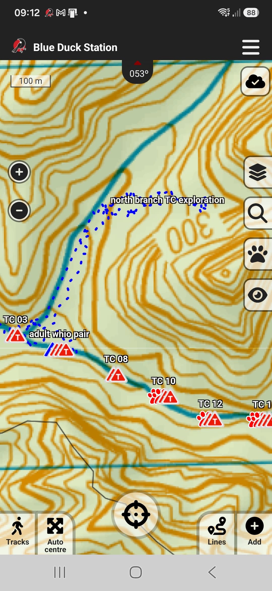
@j40gryphon that looks to me like someone has recorded a track ( App: Recording a GPS track | Trap.NZ Help & User guides), then saved it as a Point of Interest. You can quickly check whether that’s the case if you turn the Points of Interest layer filter on/off on the app.
To manage POIs, on the website go to the Manage tab and choose Points of Interest.
If you want to create a new one, you can either do it on the app by recording a track as above, drawing it manually on the website via Add - A Point of Interest (allows point, line, and polygon geometries), or pasting in your coordinates the same way as for creating a Line if you’ve recorded with a GPS. There are heaps of other optional fields as well: Installation fields | Trap.NZ Help & User guides
I like to keep my POIs tidy by creating new POI types in Project Categories (allows you to filter on the app view), and also using Tags (because currently you can’t filter by POI type under Manage on the website). So I might create a new POI type “Track” to assign the POI to, then add “track” as a tag so I can filter to show all my Tracks, and use the specific track name as the title to show on the map. I also edit my POIs to be colour-coded, but be aware that the colour selection options on the app aren’t the same as the ones on the website.
It doesn’t sound like you’ll need this function for your tracks, but it’s also worth knowing that you can add visit records to a POI. This comes in handy if you’ve got a stubborn patch of pest plants - you can create a POI when you find it, then go back and add a visit record with photos every time you do control, or add photos of the dieback after using herbicide, etc., rather than have dozens of POIs created one on top of the other at the same spot! Big patches can be marked as a polygon, which (theoretically) avoids newer team members finding regrowth at the edges and thinking they need to make more POIs to mark the ‘new’ discovery.
Some people like to create their walking tracks as Lines rather than POIs - to my mind, the big advantage of having them as POIs is the ability to selectively filter and hide them on the app if the screen gets a bit cluttered!
I’m sure this all used to be on the Help docs, and I’d intended to just give you the links rather than do a big infodump, but I couldn’t find the article I thought I remembered, so maybe it’s currently being revised???