Please add a bush monitor option, similar to bird count monitor.
This could simply be a photo point (s). We have kept goats out of area and notice naive seedlings coming through in pine plantation, would be good to plot that progress, work controlling on possums and hares should also help.
I concur JP, I really want this one as well !! Would be good to capture direction in degrees, and an option to view the original photo for context (dependent on network coverage.)
I agree with both the above.
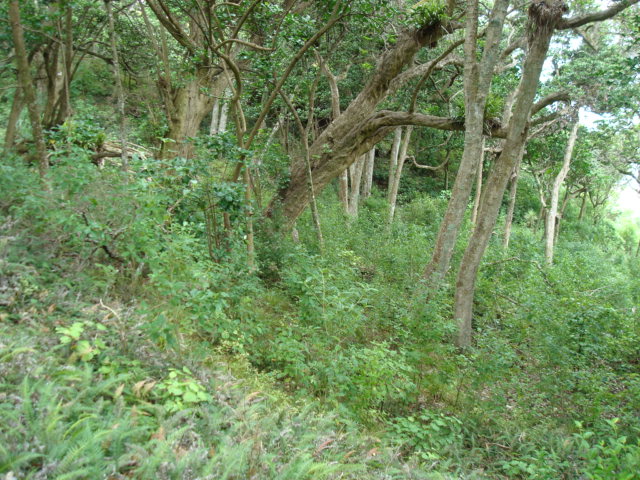
In essence I believe what we do in trapping predators is to allow what is left of our ecosystems to recover. Birds are but part and there is a strong argument that before we plant native trees we should put energy into saving existing ecosystems and their remaining mature native trees. I am working with Mahurangi College on a forest restoration project. I also trap with others in a regional park. I have attached a photo of forest regrowth in the park due solely to animal removal and predator trapping. For students to be able to see forest restoration through their actions is important.

Absolutely, I’ve been saying this for a long time. New growth and seedlings are coming up in our possum and rat free areas faster than I can plant new trees. We have QEII Blocks that have been fenced for 30 years with only karaka surviving at ground level. Three years without possums and rats and these are now a carpet of growth of every type (like your photo.) This is our nursery where we transplant local specimens from.
This needs to be captured together with bird number trends and predator removal. Perfect for schools, a generation with their eyes on their environment.
Is it possible to start a new project, using the app functions to map tree planting; using the offline gps location, setting up record categories for ongoing checks?
You can add monitoring stations then under the project categories you can enter your own terms for the monitoring species etc. You would need to be an admin for the project to add terms to project categories.