I have followed the updated guide that @scottw posted about getting the trap.nz data feed but it’s not working properly.
I have tried-
Both QGIS and ArcGIS
WFS and WMS feed types
Disable and re-enable data sharing of project
Two different projects
Creating a new API key
If I load as WMS type the layer names are showing up (default-project, my-projects-bait-stations, etc) but no points or lines ever become visible - I’ve checked with basemap off too
Are there particular values for Number of features , feature paging , or DPI mode that could be tripping me up?
I’m not sure if this is the issue you are having, but I noticed that the example URLs are improperly linked in the PDF and if clicked are missing the request part after the line break.
Apart from a possibly incomplete URL the main thing you need to do is make sure your projects have “Share summary data” ticked.
Note that you still need something in the {project-id} parameter even if you are just interested in using the collected my-projects data. Just substitute in a 0 or a 1 if you don’t want to use an actual project ID.
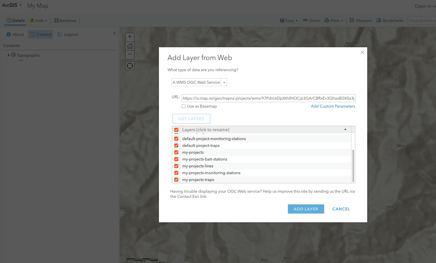
Hi Scott, Ive filled the api and project fields and you can see from the screenshot the expected layers are available - it feels so close, but just never displays anything over the basemap (Sharing summary box is checked on all projects)
I went to “description” for the layer in ArcGis and scrolled through a heap of XML and then noted that my feed’s api had been polluted by some non printing characters.