Looking at my trap line on the trap.nz web site and the app I saw that several traps were in the wrong place. Perhaps the traps had been moved before I took over the line, or perhaps the incorrect GPS coordinates were entered initially? However, several weeks ago I changed the coordinates of each incorrectly located trap on the trap.nz web site and now they correspond to the correct location on the map.
However, I see the lines between those traps have not been updated. So now the lines still go between the old, incorrect coordinates.
There seems to be a disconnect between the trap locations and the lines between them.
Thanks for that Gary - useful to know. But I’m surprised that that linestring array isn’t automatically updated whenever a trap’s coordinates are changed. I wonder if there is a good reason for that?
@Wak_Trapper is correct - if a line has location information with it, it is quite separate to trap locations.
A line is simply a mechanism for logically grouping traps or other devices and doesn’t have to have a mapped location at all. On the website and app, you can filter traps by the line name.
When the lines are mapped out, they are normally intended to show the path you would physically walk to check the traps. So not simply straight lines between traps.
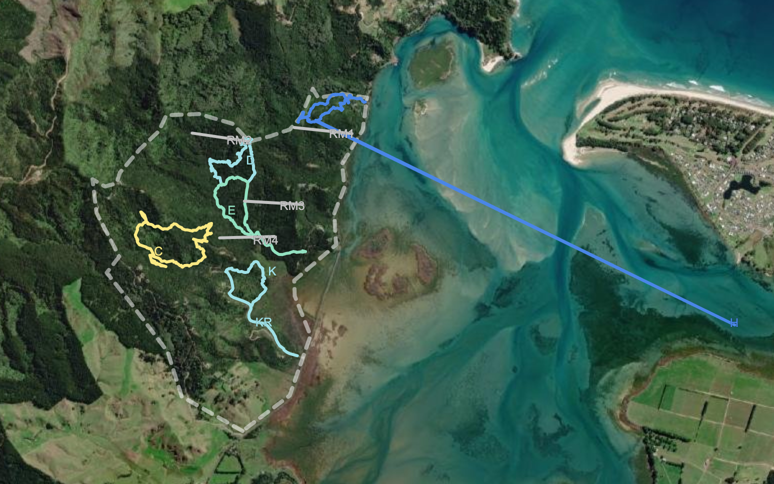
@Wak_Trapper Thanks Gary for your details on how to add new lines @dan Is there any way to edit lines - using the line recording function we have several trap lines that have large variances in them - with off-shoots up to 5 km away from actual point - have a look at the blue line in this attached image. Is there a simple way to edit these - I’ve looked at the GPS co-ordinates but with so many points it’s hard to pinpoint the one that leads the line way off the map. Thanks, Eric
Ah - that could be tricky - it actually looks like it has plotted multiple lines to the offshoot which would make it difficult to do with the web-based editor. I would suggest either tracing a new line (by hand) over the old one, or editing the line in a tool like QGIS which will let you cut parts of a line.