I record the location of all my trapping points using an Garmin eTrex 20 GPS. The location is recorded by the GPS as, for example, NZTM E1773690 N5474533. [This format is used on maps]. At present I use a LIMS conversion program to convert from NZ Transverse Mercator to NZ Geodetic Datum 2000, so I can input the location into Trap.NZ. For a few points that is no drama. However I have about 50 new points in my GPS. Is it possible to
- input the location info into Trap.NZ in NZ Transverse Mercator format, or
- Is there an easy way to get the waypoint data out of my GPS in bulk and do the conversion in bulk
You can get all of your waypoints from your eTrex using .gpx files. Garmin stores these in the directory [drive letter]:/Garmin/GPX. It’s a little clumsy since Garmin creates a new .gpx file on each day that you create a new waypoint. For example, you might have two files called Waypoints_25-SEP-19.gpx and Waypoints_21-SEP-19.gpx if you saved a couple waypoints on the 21 and 25 of Sep. (Note also that the Garmin naming convention does not sort very cleanly into chronological order.)
Copy all of the .gpx waypoint files from the Garmin to your computer. GPX files use lat/lon natively - even if your GPS is set to display NZTM (or other) format.
I use a program called “DNRGPS” to convert between .gpx and spreadsheet (.csv) formats. You can download it directly from the Minnesota Department of Natural Resources website. (Just Google ‘dnrgps’ and go directly to the state.mn.us website.) DNRGPS can load from a .gpx file and write to a .csv or .txt file. You can also use DNRGPS to add NZTM easting/northing if you want.
Once you have a spreadsheet (.csv) you can bulk load the trap locations to trap.nz.
Hope this helps!
Thanks for the help. If possible not sure if you can help me further. Looking through the requirements to use DNRGPS on the Minnesota website it is NOT compatible with MAC, which is what I use. Can you offer an alternative conversion system.
Thanks
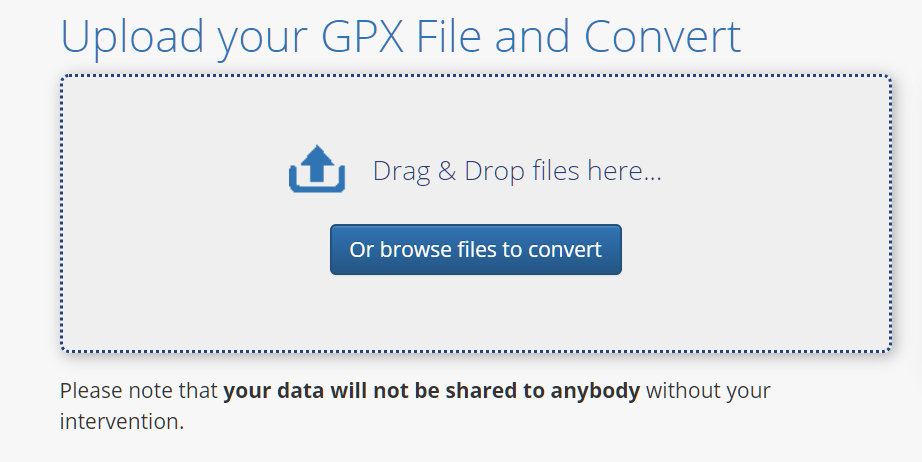
There’s an online converter for gpx files at https://mygeodata.cloud/converter/ .
-
Click on “Or browse files to convert”
-
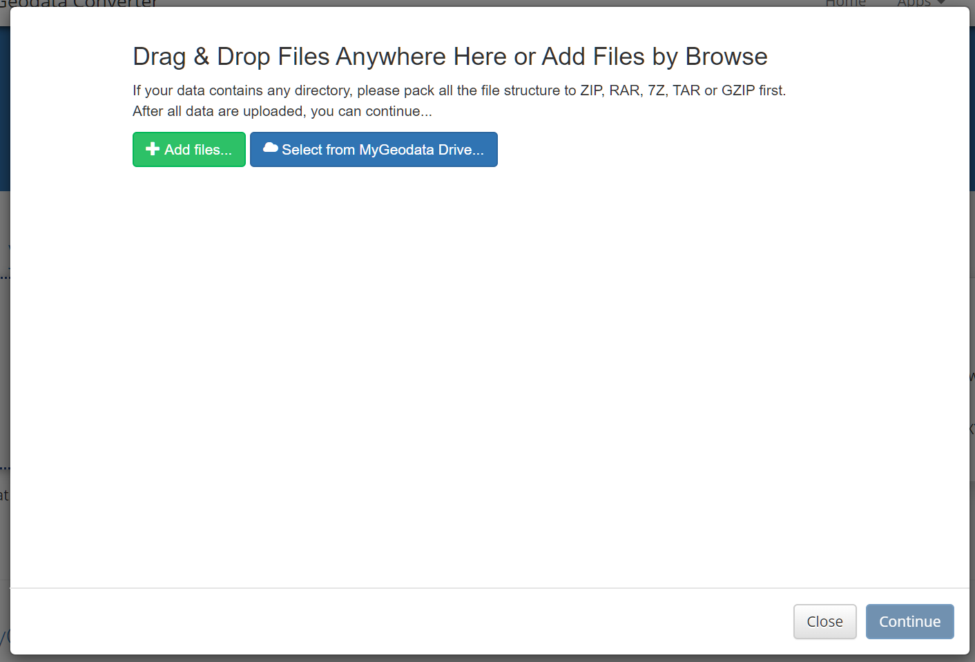
In the new window, drag and drop your gpx file(s)
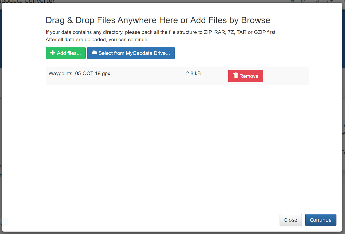
Here, I’ve uploaded one gpx file
When you’ve uploaded your gpx files, click “Continue”.
-
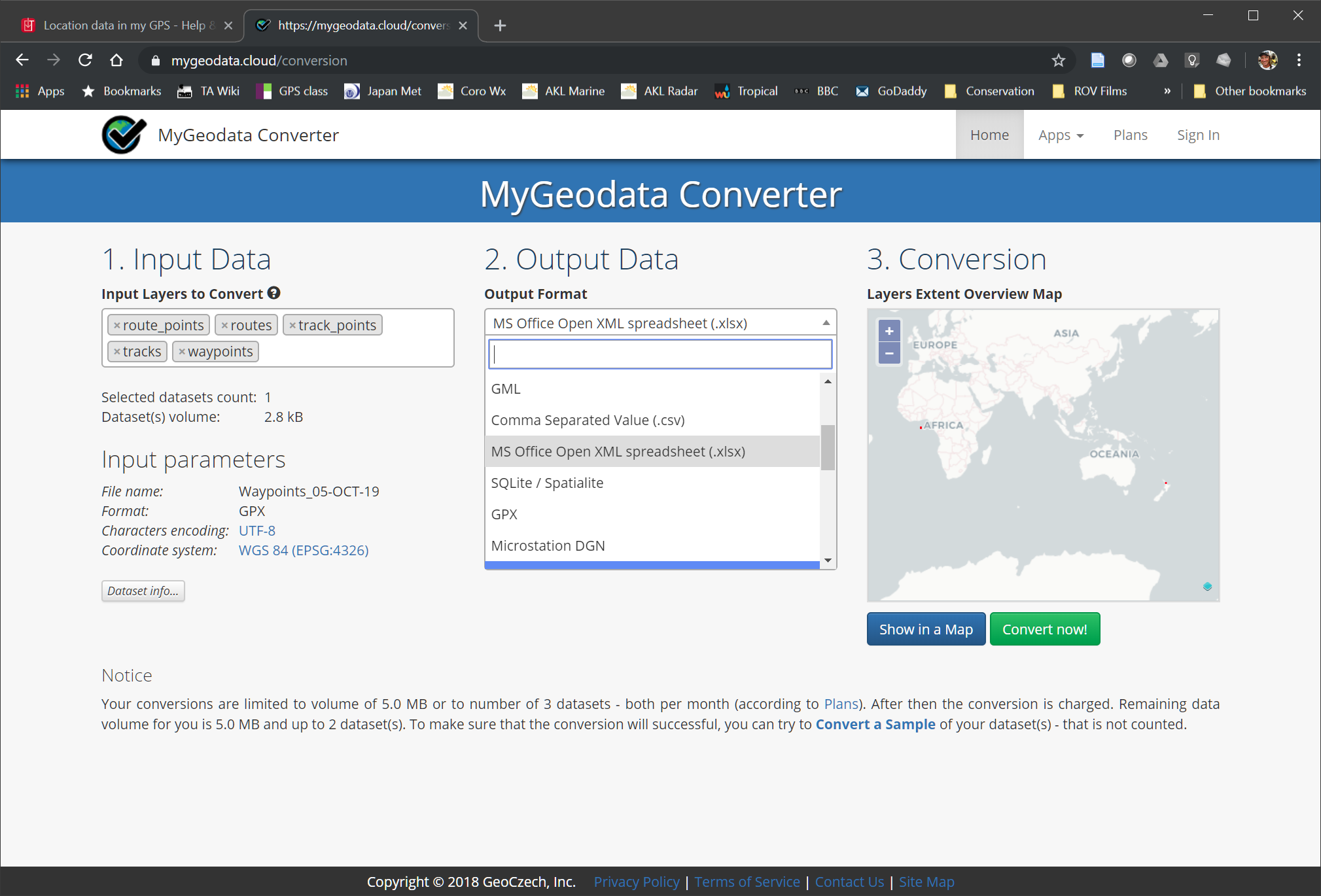
This opens the converter page.
In Section 1 - get rid of ‘routes’ ‘route_points’ ‘tracks’ & ‘track_points’ - keeping only ‘waypoints’
In Section 2 - select ‘Comma Separated Value (.csv)’ as the output format
In Secton 3 - admire the tiny red dot in New Zealand 
Finally, press “Convert now!”
-
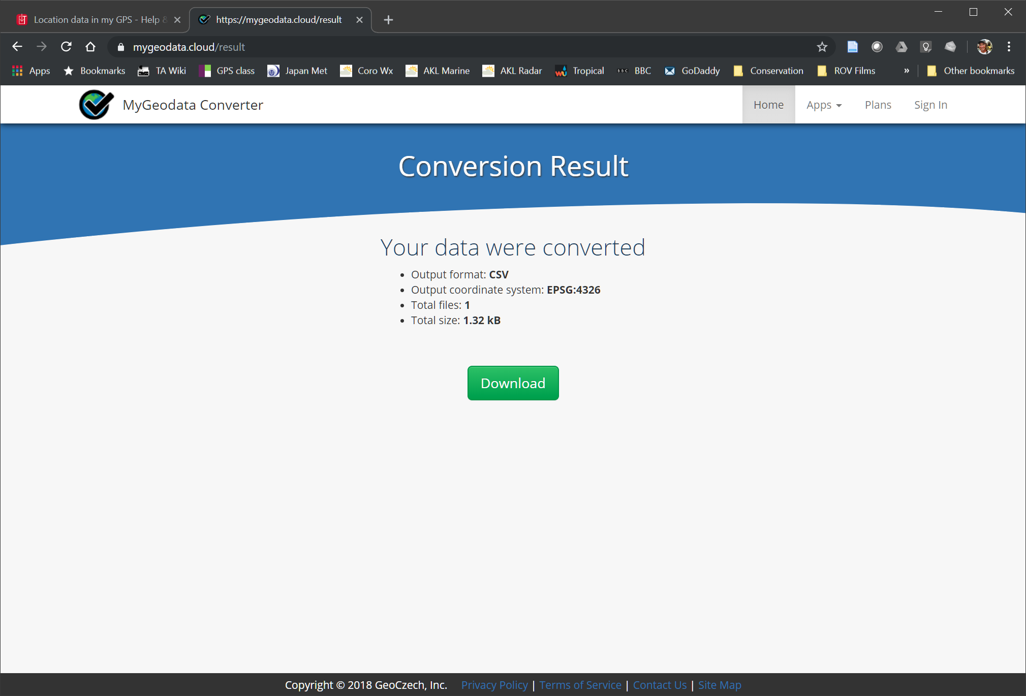
This opens the results/downloads page.
Press the “Download” button
This downloads a new csv file to your computer.
-
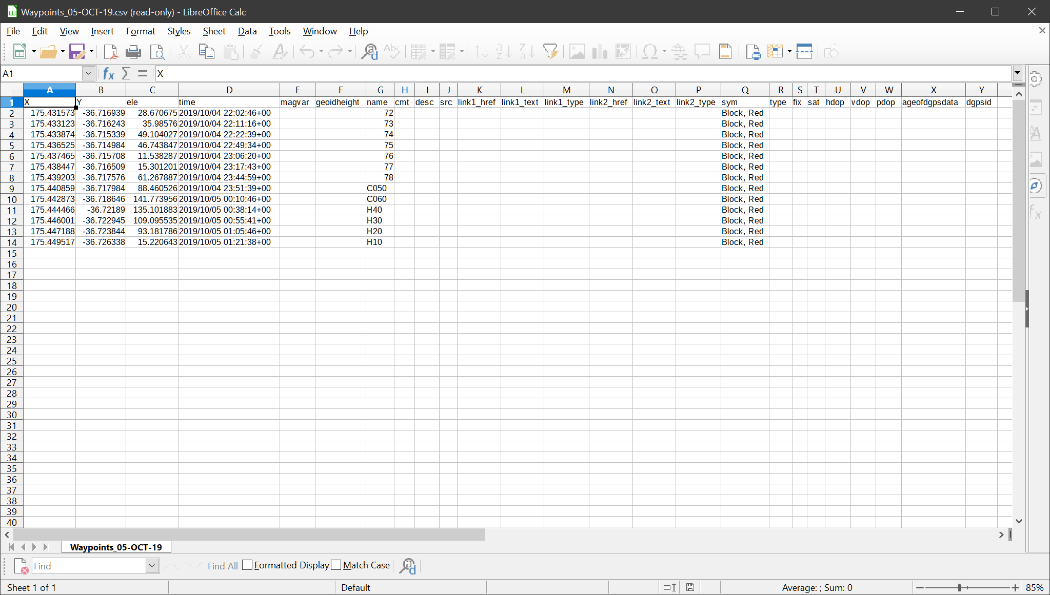
Open the csv file with your favorite spreadsheet program
This is your raw gpx data in spreadsheet form. There are a lot of empty columns.
Delete all of the columns except for X, Y, and name
-
Rename X as “long”, Y as “lat”, and name as “code”
Save your modified spreadsheet (still using csv format).
-
Now you can upload your csv file to trap.nz under Traps/Import Traps.
Hope this helps.
(If you’re the play-with-software-for-fun type, check out QGIS. It can do all of this and much, much more.)
1 Like
Many thanks, this works well. Your info will be stored in my Pest Control folder!!
We need a font of knowledge so this sort of info can be shared by everybody.
I have contacted Garmin but have yet to receive a reply
Unabashed self-promotion…
1 Like